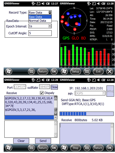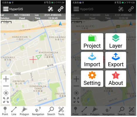
“HyperGIS” is a program launched by Howay GIS; it is an Android-based GIS Data Collection Software. This software is a complete package that is both user-friendly and versatile. The software supports benchmark conversion, local coordinate projection, point, line, surface and track functions for data collection, online map loading functions, SHP data importing, and a variety of formatted exporting options. It also features a strong layer-editing functionality that caters to real-life needs of customers.? In addition, the layers are customizable to meet the needs of different industries.
Download address:?https://play.google.com/store/apps/details?id=com.howaygis.hypergis
Or by scanning the lower two-dimensional code